 vesseltracker.com
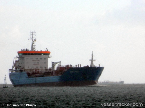
Vessel Maria Laura IMO: 9404376, MMSI: 247274700 Chemical Oil Products Tanker
UTC, 42.12202, -9.93653, course: 355, speed: 11.5
UTC, 42.46305, -9.94760, course: 357, speed: 11.8
2026-02-17 13:19:02 UTC, 42.81063, -9.94493, course: 357, speed: 11.7
Live AIS position:
UTC. 30 nm NW of Vescovato),
updated 2026-02-17 13:19:02 UTC.
Find the position of the vessel Maria Laura on the map. The latter are known coordinates and path.
marine traffic ship tracker show on live map
The current position of vessel Maria Laura is 42.81063 lat / -9.94493 lng. Updated: 2026-02-17 13:19:02 UTCCurrently sailing under the flag of Italy
Maria Laura built in 2009 year
Deadweight:
17011 tDetails:
Last coordinates of the vessel:
UTC, 41.73840, -9.95135, course: 0, speed: 11.8UTC, 42.12202, -9.93653, course: 355, speed: 11.5
UTC, 42.46305, -9.94760, course: 357, speed: 11.8
2026-02-17 13:19:02 UTC, 42.81063, -9.94493, course: 357, speed: 11.7