 vesseltracker.com
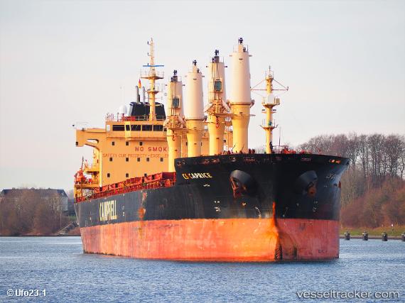
Vessel Cs Caprice IMO: 9406104, MMSI: 311016600 Bulk Carrier
UTC, 25.87833, -76.52500, course: -1, speed: 10
UTC, 25.99167, -75.98333, course: -1, speed: 10
2026-02-18 13:32:49 UTC, 26.05167, -75.71667, course: -1, speed: 11
Live AIS position:
UTC. 60 nm NE of Harbour Island),
updated 2026-02-18 13:32:49 UTC.
Find the position of the vessel Cs Caprice on the map. The latter are known coordinates and path.
marine traffic ship tracker show on live map
The current position of vessel Cs Caprice is 26.05167 lat / -75.71667 lng. Updated: 2026-02-18 13:32:49 UTCCurrently sailing under the flag of Bahamas
Cs Caprice built in 2010 year
Deadweight:
30465 tDetails:
Last coordinates of the vessel:
UTC, 25.75500, -76.93167, course: -1, speed: 11UTC, 25.87833, -76.52500, course: -1, speed: 10
UTC, 25.99167, -75.98333, course: -1, speed: 10
2026-02-18 13:32:49 UTC, 26.05167, -75.71667, course: -1, speed: 11