 vesseltracker.com
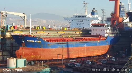
Vessel Kemal Kuru IMO: 9418080, MMSI: 352437000 General Cargo Ship
UTC, 39.33795, 22.96139, course: 315, speed: 0
UTC, 39.33814, 22.96175, course: 306, speed: 0.1
2026-02-18 20:26:22 UTC, 39.33816, 22.96165, course: 304, speed: 0
Live AIS position:
UTC. Near Volos),
updated 2026-02-18 20:26:22 UTC.
Find the position of the vessel Kemal Kuru on the map. The latter are known coordinates and path.
marine traffic ship tracker show on live map
The current position of vessel Kemal Kuru is 39.33816 lat / 22.96165 lng. Updated: 2026-02-18 20:26:22 UTCDetails:
Last coordinates of the vessel:
UTC, 39.33788, 22.96129, course: 329, speed: 0.1UTC, 39.33795, 22.96139, course: 315, speed: 0
UTC, 39.33814, 22.96175, course: 306, speed: 0.1
2026-02-18 20:26:22 UTC, 39.33816, 22.96165, course: 304, speed: 0