 vesseltracker.com
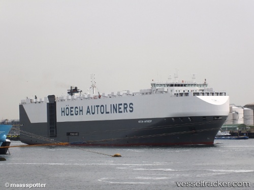
Vessel Hoegh Antwerp IMO: 9441623, MMSI: 311000101 Vehicles Carrier
UTC, -46.52904, -75.77990, course: 3, speed: 15.4
UTC, -46.02283, -75.67985, course: 8, speed: 15.3
2026-02-10 22:08:34 UTC, -45.35500, -75.54167, course: -1, speed: 14
Live AIS position:
UTC. 114 nm W of Puerto Chacabuco),
updated 2026-02-10 22:08:34 UTC.
Find the position of the vessel Hoegh Antwerp on the map. The latter are known coordinates and path.
marine traffic ship tracker show on live map
The current position of vessel Hoegh Antwerp is -45.35500 lat / -75.54167 lng. Updated: 2026-02-10 22:08:34 UTCCurrently sailing under the flag of Bahamas
Hoegh Antwerp built in 2013 year
Deadweight:
21000 tDetails:
Last coordinates of the vessel:
UTC, -46.86661, -75.78721, course: 351, speed: 14.8UTC, -46.52904, -75.77990, course: 3, speed: 15.4
UTC, -46.02283, -75.67985, course: 8, speed: 15.3
2026-02-10 22:08:34 UTC, -45.35500, -75.54167, course: -1, speed: 14