 vesseltracker.com
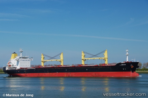
Vessel Agios Fanourios IMO: 9465368, MMSI: 636018062 Bulk Carrier
UTC, 37.59449, 5.62489, course: 274, speed: 10.1
UTC, 37.59481, 5.42449, course: -1, speed: 10.1
2026-02-26 20:16:02 UTC, 37.59816, 4.79852, course: 270, speed: 10.7
Live AIS position:
UTC. Near Santaella),
updated 2026-02-26 20:16:02 UTC.
Find the position of the vessel Agios Fanourios on the map. The latter are known coordinates and path.
marine traffic ship tracker show on live map
The current position of vessel Agios Fanourios is 37.59816 lat / 4.79852 lng. Updated: 2026-02-26 20:16:02 UTCCurrently sailing under the flag of Liberia
Agios Fanourios built in 2009 year
Deadweight:
33261 tDetails:
Last coordinates of the vessel:
UTC, 37.59848, 6.30464, course: -1, speed: 10.1UTC, 37.59449, 5.62489, course: 274, speed: 10.1
UTC, 37.59481, 5.42449, course: -1, speed: 10.1
2026-02-26 20:16:02 UTC, 37.59816, 4.79852, course: 270, speed: 10.7