 vesseltracker.com
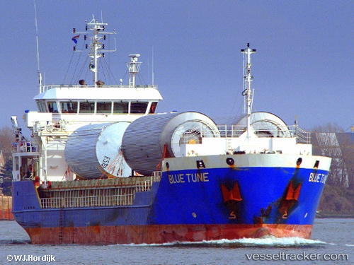
Vessel Blue Tune IMO: 9491927, MMSI: 305566000 General Cargo Ship
UTC, 37.82460, -0.45347, course: 198, speed: 6.4
UTC, 37.68833, -0.49500, course: -1, speed: 5
2026-02-07 13:44:32 UTC, 37.52980, -0.67722, course: 256, speed: 5.7
Live AIS position:
UTC. Near Cabo de Palos),
updated 2026-02-07 13:44:32 UTC.
Find the position of the vessel Blue Tune on the map. The latter are known coordinates and path.
marine traffic ship tracker show on live map
The current position of vessel Blue Tune is 37.52980 lat / -0.67722 lng. Updated: 2026-02-07 13:44:32 UTCCurrently sailing under the flag of Antigua Barbuda
Blue Tune built in 2010 year
Deadweight:
5193 tDetails:
Last coordinates of the vessel:
UTC, 38.15346, -0.32711, course: 217, speed: 7.6UTC, 37.82460, -0.45347, course: 198, speed: 6.4
UTC, 37.68833, -0.49500, course: -1, speed: 5
2026-02-07 13:44:32 UTC, 37.52980, -0.67722, course: 256, speed: 5.7