 vesseltracker.com
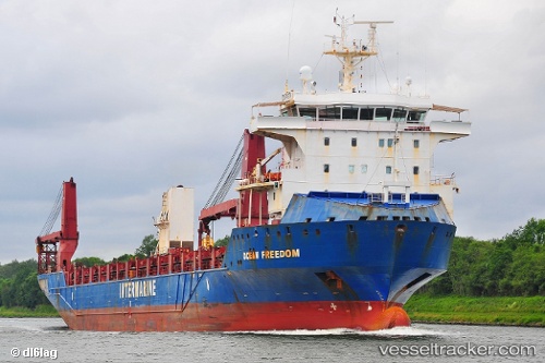
Vessel Ocean Freedom IMO: 9506722, MMSI: 367503980 Heavy Load Carrier
UTC, 3.15662, 100.61624, course: 308, speed: 12.1
UTC, 3.46274, 100.22356, course: 307, speed: 12.5
2026-02-25 17:32:10 UTC, 3.69642, 99.96931, course: 311, speed: 12.8
Live AIS position:
UTC. 18 nm SW of Pulau Jarak),
updated 2026-02-25 17:32:10 UTC.
Find the position of the vessel Ocean Freedom on the map. The latter are known coordinates and path.
marine traffic ship tracker show on live map
The current position of vessel Ocean Freedom is 3.69642 lat / 99.96931 lng. Updated: 2026-02-25 17:32:10 UTCDetails:
Last coordinates of the vessel:
UTC, 2.91657, 100.90820, course: 315, speed: 11.3UTC, 3.15662, 100.61624, course: 308, speed: 12.1
UTC, 3.46274, 100.22356, course: 307, speed: 12.5
2026-02-25 17:32:10 UTC, 3.69642, 99.96931, course: 311, speed: 12.8