 vesseltracker.com
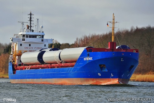
Vessel Ostbense IMO: 9566784, MMSI: 305631000 General Cargo Ship
UTC, 35.87486, -4.71639, course: 169, speed: 2.4
UTC, 35.86320, -4.71297, course: 233, speed: 9.8
2026-02-06 15:55:10 UTC, 35.77811, -4.86585, course: 235, speed: 1.9
Live AIS position:
UTC. 22 nm NE of Martil),
updated 2026-02-06 15:55:10 UTC.
Find the position of the vessel Ostbense on the map. The latter are known coordinates and path.
marine traffic ship tracker show on live map
The current position of vessel Ostbense is 35.77811 lat / -4.86585 lng. Updated: 2026-02-06 15:55:10 UTCCurrently sailing under the flag of Antigua Barbuda
Ostbense built in 2011 year
Deadweight:
7500 tDetails:
Last coordinates of the vessel:
UTC, 35.84882, -4.76468, course: 179, speed: 2.5UTC, 35.87486, -4.71639, course: 169, speed: 2.4
UTC, 35.86320, -4.71297, course: 233, speed: 9.8
2026-02-06 15:55:10 UTC, 35.77811, -4.86585, course: 235, speed: 1.9