 vesseltracker.com
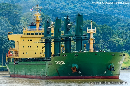
Vessel Leonor IMO: 9571571, MMSI: 357775000 Bulk Carrier
UTC, 23.85265, -61.61048, course: 53, speed: 10.7
UTC, 24.06343, -61.32995, course: 53, speed: 10.7
2026-02-28 03:58:14 UTC, 24.25667, -61.06500, course: -1, speed: 11
Live AIS position:
UTC. 199 nm W of Villa Elisa),
updated 2026-02-28 03:58:14 UTC.
Find the position of the vessel Leonor on the map. The latter are known coordinates and path.
marine traffic ship tracker show on live map
The current position of vessel Leonor is 24.25667 lat / -61.06500 lng. Updated: 2026-02-28 03:58:14 UTCDetails:
Last coordinates of the vessel:
UTC, 23.55333, -62.00333, course: -1, speed: 10UTC, 23.85265, -61.61048, course: 53, speed: 10.7
UTC, 24.06343, -61.32995, course: 53, speed: 10.7
2026-02-28 03:58:14 UTC, 24.25667, -61.06500, course: -1, speed: 11