 vesseltracker.com
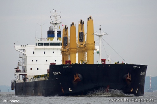
Vessel Elina B IMO: 9577446, MMSI: 248826000 Bulk Carrier
UTC, 38.83510, 118.17468, course: 260, speed: 2.8
UTC, 38.83295, 118.18184, course: 324, speed: 3
2026-02-08 17:58:05 UTC, 38.84052, 118.17462, course: 159, speed: 0.1
Live AIS position:
UTC. Near Taku Bar),
updated 2026-02-08 17:58:05 UTC.
Find the position of the vessel Elina B on the map. The latter are known coordinates and path.
marine traffic ship tracker show on live map
The current position of vessel Elina B is 38.84052 lat / 118.17462 lng. Updated: 2026-02-08 17:58:05 UTCDetails:
Last coordinates of the vessel:
UTC, 38.84638, 118.43413, course: 280, speed: 8.9UTC, 38.83510, 118.17468, course: 260, speed: 2.8
UTC, 38.83295, 118.18184, course: 324, speed: 3
2026-02-08 17:58:05 UTC, 38.84052, 118.17462, course: 159, speed: 0.1