 vesseltracker.com
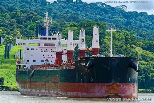
Vessel St Pinot IMO: 9596179, MMSI: 538007639 Bulk Carrier
UTC, 32.38824, -62.44623, course: 301, speed: 7.1
UTC, 32.51796, -62.69219, course: 300, speed: 7.2
2026-02-24 17:26:07 UTC, 32.61505, -62.88656, course: 300, speed: 6.6
Live AIS position:
UTC. 92 nm E of Saint George),
updated 2026-02-24 17:26:07 UTC.
Find the position of the vessel St Pinot on the map. The latter are known coordinates and path.
marine traffic ship tracker show on live map
The current position of vessel St Pinot is 32.61505 lat / -62.88656 lng. Updated: 2026-02-24 17:26:07 UTCCurrently sailing under the flag of Marshall Is
St Pinot built in 2013 year
Deadweight:
57949 tDetails:
Last coordinates of the vessel:
UTC, 32.31334, -62.19038, course: 281, speed: 7UTC, 32.38824, -62.44623, course: 301, speed: 7.1
UTC, 32.51796, -62.69219, course: 300, speed: 7.2
2026-02-24 17:26:07 UTC, 32.61505, -62.88656, course: 300, speed: 6.6