 vesseltracker.com
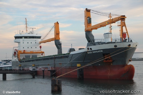
Vessel Trade Navigator IMO: 9631371, MMSI: 244650331 General Cargo Ship
UTC, 53.75457, 6.03075, course: 249, speed: 11.8
UTC, 53.61923, 5.34072, course: 251, speed: 10
2026-02-24 09:37:30 UTC, 53.55865, 5.05605, course: 246, speed: 9.8
Live AIS position:
UTC. 13 nm NW of TERSCHELLING),
updated 2026-02-24 09:37:30 UTC.
Find the position of the vessel Trade Navigator on the map. The latter are known coordinates and path.
marine traffic ship tracker show on live map
The current position of vessel Trade Navigator is 53.55865 lat / 5.05605 lng. Updated: 2026-02-24 09:37:30 UTCCurrently sailing under the flag of Netherlands
Details:
Last coordinates of the vessel:
UTC, 53.86043, 6.64150, course: 254, speed: 11.7UTC, 53.75457, 6.03075, course: 249, speed: 11.8
UTC, 53.61923, 5.34072, course: 251, speed: 10
2026-02-24 09:37:30 UTC, 53.55865, 5.05605, course: 246, speed: 9.8