 vesseltracker.com
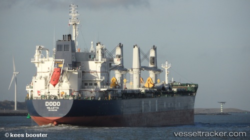
Vessel Dodo IMO: 9662320, MMSI: 229411000 Bulk Carrier
UTC, -27.82013, 153.79720, course: 177, speed: 12.6
UTC, -28.19845, 153.80493, course: 178, speed: 13.3
2026-02-09 17:28:52 UTC, -28.66173, 153.81142, course: 194, speed: 13.3
Live AIS position:
UTC. 10 nm E of Byron Bay),
updated 2026-02-09 17:28:52 UTC.
Find the position of the vessel Dodo on the map. The latter are known coordinates and path.
marine traffic ship tracker show on live map
The current position of vessel Dodo is -28.66173 lat / 153.81142 lng. Updated: 2026-02-09 17:28:52 UTCDetails:
Last coordinates of the vessel:
UTC, -27.48161, 153.78268, course: 176, speed: 12.3UTC, -27.82013, 153.79720, course: 177, speed: 12.6
UTC, -28.19845, 153.80493, course: 178, speed: 13.3
2026-02-09 17:28:52 UTC, -28.66173, 153.81142, course: 194, speed: 13.3