 vesseltracker.com
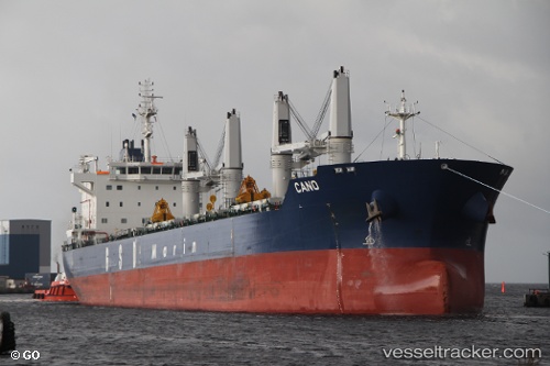
Vessel Cano IMO: 9662332, MMSI: 229410000 Bulk Carrier
UTC, 48.86950, -148.63770, course: 80, speed: 12.6
UTC, 48.92357, -147.90013, course: 83, speed: 12.8
2026-02-08 17:29:37 UTC, 48.96650, -147.43779, course: 83, speed: 13.3
Live AIS position:
UTC. 184 nm SE of Drinagh),
updated 2026-02-08 17:29:37 UTC.
Find the position of the vessel Cano on the map. The latter are known coordinates and path.
marine traffic ship tracker show on live map
The current position of vessel Cano is 48.96650 lat / -147.43779 lng. Updated: 2026-02-08 17:29:37 UTCCurrently sailing under the flag of Malta
Cano built in 2013 year
Deadweight:
38980 tDetails:
Last coordinates of the vessel:
UTC, 48.79347, -149.30028, course: 78, speed: 12.9UTC, 48.86950, -148.63770, course: 80, speed: 12.6
UTC, 48.92357, -147.90013, course: 83, speed: 12.8
2026-02-08 17:29:37 UTC, 48.96650, -147.43779, course: 83, speed: 13.3