 vesseltracker.com
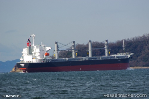
Vessel Gardenia K IMO: 9675559, MMSI: 538005411 Bulk Carrier
UTC, -36.71155, -73.10776, course: 352, speed: 0
UTC, -36.71152, -73.10777, course: 352, speed: 0
2026-02-13 01:41:03 UTC, -36.71159, -73.10773, course: 352, speed: 0
Live AIS position:
UTC. Near Talcahuano),
updated 2026-02-13 01:41:03 UTC.
Find the position of the vessel Gardenia K on the map. The latter are known coordinates and path.
marine traffic ship tracker show on live map
The current position of vessel Gardenia K is -36.71159 lat / -73.10773 lng. Updated: 2026-02-13 01:41:03 UTCDetails:
Last coordinates of the vessel:
UTC, -36.71153, -73.10774, course: 352, speed: 0UTC, -36.71155, -73.10776, course: 352, speed: 0
UTC, -36.71152, -73.10777, course: 352, speed: 0
2026-02-13 01:41:03 UTC, -36.71159, -73.10773, course: 352, speed: 0