 vesseltracker.com
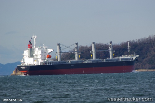
Vessel Gardenia K IMO: 9675559, MMSI: 538005411 Bulk Carrier
UTC, -33.59428, -71.66066, course: 280, speed: 0
UTC, -33.59377, -71.66063, course: 262, speed: 0.1
2026-01-29 14:20:52 UTC, -33.59511, -71.66086, course: 296, speed: 0.3
Live AIS position:
UTC. Near San Antonio),
updated 2026-01-29 14:20:52 UTC.
Find the position of the vessel Gardenia K on the map. The latter are known coordinates and path.
marine traffic ship tracker show on live map
The current position of vessel Gardenia K is -33.59511 lat / -71.66086 lng. Updated: 2026-01-29 14:20:52 UTCDetails:
Last coordinates of the vessel:
UTC, -33.59517, -71.66097, course: 300, speed: 0.1UTC, -33.59428, -71.66066, course: 280, speed: 0
UTC, -33.59377, -71.66063, course: 262, speed: 0.1
2026-01-29 14:20:52 UTC, -33.59511, -71.66086, course: 296, speed: 0.3