 vesseltracker.com
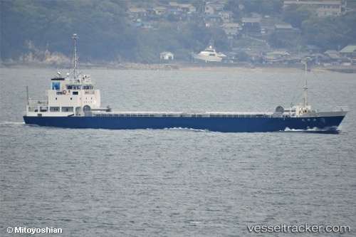
Vessel Masuei Maru IMO: 9805829, MMSI: 431008431 General Cargo Ship
UTC, 33.88076, 130.76419, course: 73, speed: 0
UTC, 33.88075, 130.76414, course: 72, speed: 0
2026-02-15 15:34:58 UTC, 33.88070, 130.76418, course: 72, speed: 0
Live AIS position:
UTC. Near YAWATA),
updated 2026-02-15 15:34:58 UTC.
Find the position of the vessel Masuei Maru on the map. The latter are known coordinates and path.
marine traffic ship tracker show on live map
The current position of vessel Masuei Maru is 33.88070 lat / 130.76418 lng. Updated: 2026-02-15 15:34:58 UTCCurrently sailing under the flag of Japan
Details:
Last coordinates of the vessel:
UTC, 33.88073, 130.76418, course: 73, speed: 0UTC, 33.88076, 130.76419, course: 73, speed: 0
UTC, 33.88075, 130.76414, course: 72, speed: 0
2026-02-15 15:34:58 UTC, 33.88070, 130.76418, course: 72, speed: 0