 vesseltracker.com
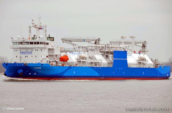
Vessel Kairos IMO: 9819882, MMSI: 209275000 Lng Tanker
UTC, 57.58375, 11.68315, course: 239, speed: 0
UTC, 57.58422, 11.68238, course: 253, speed: 0
2026-01-29 10:04:30 UTC, 57.58532, 11.68198, course: 295, speed: 0
Live AIS position:
UTC. Near Sandvik, Styrsö),
updated 2026-01-29 10:04:30 UTC.
Find the position of the vessel Kairos on the map. The latter are known coordinates and path.
marine traffic ship tracker show on live map
The current position of vessel Kairos is 57.58532 lat / 11.68198 lng. Updated: 2026-01-29 10:04:30 UTCCurrently sailing under the flag of Cyprus
Details:
Last coordinates of the vessel:
UTC, 57.58323, 11.68614, course: 211, speed: 0.5UTC, 57.58375, 11.68315, course: 239, speed: 0
UTC, 57.58422, 11.68238, course: 253, speed: 0
2026-01-29 10:04:30 UTC, 57.58532, 11.68198, course: 295, speed: 0