 vesseltracker.com
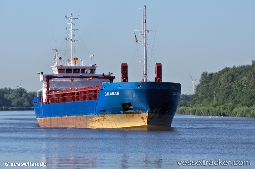
 CALAMAR
Current Status
Where is the vessel?
CALAMAR is currently in 17 nm N of Terschelling, based on AIS data received about 1h ago.
Latest AIS update:
Current position: 53.66321° N, 5.51499° E (17 nm N of Terschelling)
Average speed (last 7 days): Loading…
Average speed (last 30 days): Loading…
Vessel profile: CALAMAR is a General Cargo Ship with dimensions 88m x 12m.
This page combines live AIS, route history, probable destination signals, nearby traffic, and port activity for practical vessel monitoring.
The current position of vessel CALAMAR is 53.66321 lat / 5.51499 lng. Updated: 2026-04-07 07:26:56 UTCNearest reference points:
- Near FRANEKER
- Near HARLINGEN
- 14 nm NW of Town Quays/Drogheda
Currently sailing under the flag of Cyprus ![]()
CALAMAR built in 2011 year
Deadweight:
4030 tDetails:
Live Vessel CALAMAR Analytics (details, animations, etc.)
Recent AIS points (UTC):
2026-04-07 01:27:35 UTC · 53.93186, 7.11088 · SOG 10.1 kn · COG 259°2026-04-07 04:16:15 UTC · 53.81658, 6.33400 · SOG 10.4 kn · COG 252°
2026-04-07 06:18:05 UTC · 53.72069, 5.79832 · SOG 9.5 kn · COG 252°
2026-04-07 07:26:56 UTC · 53.66321, 5.51499 · SOG 9.2 kn · COG 251°