 vesseltracker.com
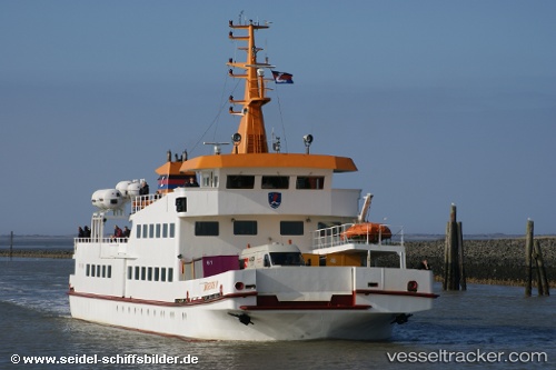
Langeoog 4
Current StatusWhere is the vessel?
Langeoog 4 is currently in Near BENSERSIEL, based on AIS data received about 1d ago.
Latest AIS update:
Current position: 53.67796° N, 7.57354° E (Near BENSERSIEL)
Average speed (last 7 days): Loading…
Average speed (last 30 days): Loading…
Vessel profile: Langeoog 4 is a Passenger Ship with dimensions 10m x 46m.
This page combines live AIS, route history, probable destination signals, nearby traffic, and port activity for practical vessel monitoring.
The current position of vessel Langeoog 4 is 53.67796 lat / 7.57354 lng. Updated: 2026-04-10 07:27:25 UTCNearest reference points:
- Near Wangerooge
- Near NORDDEICH
- Near NORDERNEY
Details:
Live Vessel Langeoog 4 Analytics (details, animations, etc.)
Recent AIS points (UTC):
2026-04-10 02:24:09 UTC · 53.67800, 7.57338 · SOG 0 kn · COG 91°2026-04-10 03:48:11 UTC · 53.67800, 7.57351 · SOG 0 kn · COG 91°
2026-04-10 05:58:11 UTC · 53.67881, 7.57140 · SOG 6.1 kn · COG 143°
2026-04-10 07:27:25 UTC · 53.67796, 7.57354 · SOG 0 kn · COG 91°