 vesseltracker.com
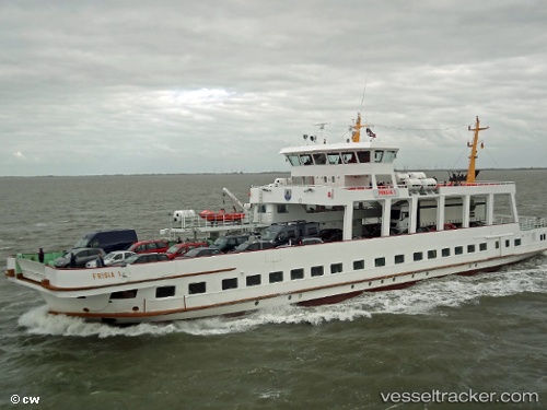
Vessel Frisia I IMO: 7018604, MMSI: 211272260 Passenger Ro Ro Cargo Ship
UTC, 53.69779, 7.16371, course: 277, speed: 0
UTC, 53.69781, 7.16369, course: 277, speed: 0
2026-01-29 21:37:03 UTC, 53.69783, 7.16374, course: 278, speed: 0
Live AIS position:
UTC. Near NORDERNEY),
updated 2026-01-29 21:37:03 UTC.
Find the position of the vessel Frisia I on the map. The latter are known coordinates and path.
marine traffic ship tracker show on live map
The current position of vessel Frisia I is 53.69783 lat / 7.16374 lng. Updated: 2026-01-29 21:37:03 UTCCurrently sailing under the flag of Germany
Frisia I built in 1970 year
Deadweight:
244 tDetails:
Last coordinates of the vessel:
UTC, 53.63090, 7.15705, course: 355, speed: 8UTC, 53.69779, 7.16371, course: 277, speed: 0
UTC, 53.69781, 7.16369, course: 277, speed: 0
2026-01-29 21:37:03 UTC, 53.69783, 7.16374, course: 278, speed: 0