 vesseltracker.com
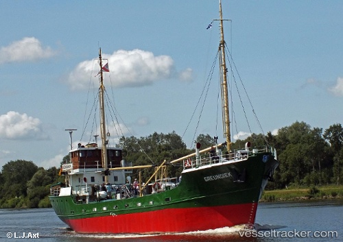
Greundiek
Current StatusWhere is the vessel?
Greundiek is currently in Near STADE, based on AIS data received about 3d ago.
Latest AIS update:
Current position: 53.60358° N, 9.47868° E (Near STADE)
Average speed (last 7 days): Loading…
Average speed (last 30 days): Loading…
Vessel profile: Greundiek is a General Cargo Ship with dimensions 7m x 47m.
This page combines live AIS, route history, probable destination signals, nearby traffic, and port activity for practical vessel monitoring.
The current position of vessel Greundiek is 53.60358 lat / 9.47868 lng. Updated: 2026-04-03 16:44:24 UTCNearest reference points:
- Near STADE
- Near Stader Sand
- Near Abbenfleth
Details:
Live Vessel Greundiek Analytics (details, animations, etc.)
Recent AIS points (UTC):
2026-04-03 16:24:33 UTC · 53.60754, 9.48693 · SOG 3.3 kn · COG -1°2026-04-03 16:44:24 UTC · 53.60358, 9.47868 · SOG 0 kn · COG -1°
2026-04-03 16:44:24 UTC · 53.60358, 9.47868 · SOG 0 kn · COG -1°
2026-04-03 16:44:24 UTC · 53.60358, 9.47868 · SOG 0 kn · COG -1°