 vesseltracker.com
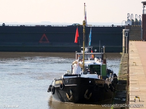
Vessel Herrentor IMO: 5100740, MMSI: 211474890 Heavy Load Carrier
Live AIS position:
UTC. Near ZAANDAM),
updated 2026-01-08 17:21:29 UTC.
Find the position of the vessel Herrentor on the map. The latter are known coordinates and path.
marine traffic ship tracker show on live map
The current position of vessel Herrentor is 52.43225 lat / 4.82442 lng. Updated: 2026-01-08 17:21:29 UTCCurrently sailing under the flag of Germany
Details:
Last coordinates of the vessel:
2026-01-08 17:21:29 UTC, 52.43225, 4.82442, course: 297, speed: 0