 vesseltracker.com
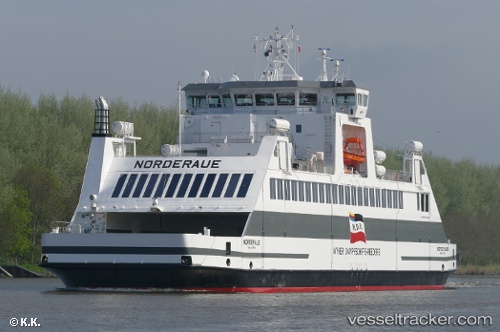
 Norderaue
Current Status
Where is the vessel?
Norderaue is currently in Near Galmsbüll, based on AIS data received about 1h ago.
Latest AIS update:
Current position: 54.73045° N, 8.68980° E (Near Galmsbüll)
Average speed (last 7 days): Loading…
Average speed (last 30 days): Loading…
Vessel profile: Norderaue is a Dredger with dimensions 76m x 17m.
This page combines live AIS, route history, probable destination signals, nearby traffic, and port activity for practical vessel monitoring.
The current position of vessel Norderaue is 54.73045 lat / 8.68980 lng. Updated: 2026-04-12 21:28:20 UTCNearest reference points:
- Near BUESUM
- Near Basel
- Near Flensburg
Currently sailing under the flag of Germany ![]()
Details:
Live Vessel Norderaue Analytics (details, animations, etc.)
Recent AIS points (UTC):
2026-04-12 15:31:19 UTC · 54.73047, 8.68973 · SOG 0 kn · COG 287°2026-04-12 17:46:40 UTC · 54.63531, 8.42595 · SOG 11 kn · COG 226°
2026-04-12 19:49:20 UTC · 54.73045, 8.68980 · SOG 0 kn · COG 288°
2026-04-12 21:28:20 UTC · 54.73045, 8.68980 · SOG 0 kn · COG 288°