 vesseltracker.com
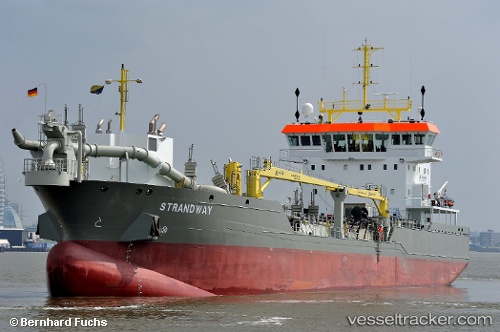
Vessel Strandway IMO: 9664457, MMSI: 212396000 Hopper Dredger
UTC, 51.46098, 3.69509, course: 149, speed: 0
UTC, 51.46100, 3.69509, course: 149, speed: 0
2026-03-01 20:13:16 UTC, 51.46099, 3.69506, course: 149, speed: 0
Live AIS position:
UTC. Near Nieuwdorp),
updated 2026-03-01 20:13:16 UTC.
Find the position of the vessel Strandway on the map. The latter are known coordinates and path.
marine traffic ship tracker show on live map
The current position of vessel Strandway is 51.46099 lat / 3.69506 lng. Updated: 2026-03-01 20:13:16 UTCCurrently sailing under the flag of Cyprus
Strandway built in 2014 year
Deadweight:
5950 tDetails:
Last coordinates of the vessel:
UTC, 51.46099, 3.69508, course: 149, speed: 0UTC, 51.46098, 3.69509, course: 149, speed: 0
UTC, 51.46100, 3.69509, course: 149, speed: 0
2026-03-01 20:13:16 UTC, 51.46099, 3.69506, course: 149, speed: 0