 vesseltracker.com
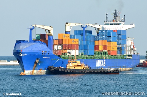
Vessel Mario A IMO: 9337377, MMSI: 215177000 Container Ship
UTC, 4.765, -9.29167, course: -1, speed: 15
UTC, 5.09829, -9.88495, course: 298, speed: 15.2
2026-02-06 04:27:16 UTC, 5.39428, -10.404, course: 299, speed: 14.4
Live AIS position:
UTC. 35 nm SW of Buchanan),
updated 2026-02-06 04:27:16 UTC.
Find the position of the vessel Mario A on the map. The latter are known coordinates and path.
marine traffic ship tracker show on live map
The current position of vessel Mario A is 5.39428 lat / -10.404 lng. Updated: 2026-02-06 04:27:16 UTCCurrently sailing under the flag of Malta
Mario A built in 2007 year
Deadweight:
22016 tDetails:
Last coordinates of the vessel:
UTC, 4.56834, -8.95253, course: 296, speed: 14.9UTC, 4.765, -9.29167, course: -1, speed: 15
UTC, 5.09829, -9.88495, course: 298, speed: 15.2
2026-02-06 04:27:16 UTC, 5.39428, -10.404, course: 299, speed: 14.4