 vesseltracker.com
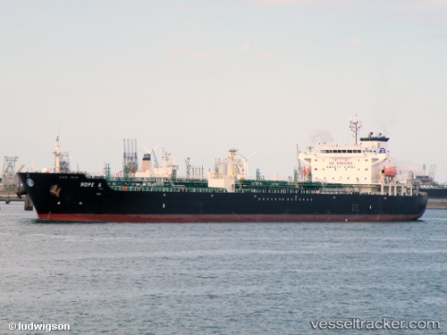
 Hope A
Current Status
Where is the vessel?
Hope A is currently in Near PERAMA, based on AIS data received less than 1h ago.
Latest AIS update:
Current position: 37.95100° N, 23.57220° E (Near PERAMA)
Average speed (last 7 days): Loading…
Average speed (last 30 days): Loading…
Vessel profile: Hope A is a Chemical Oil Products Tanker with dimensions 171m x 28m.
This page combines live AIS, route history, probable destination signals, nearby traffic, and port activity for practical vessel monitoring.
The current position of vessel Hope A is 37.951 lat / 23.5722 lng. Updated: 2026-04-15 21:44:26 UTCNearest reference points:
- Near PERAMA
- Near Drapetzona
- Near Keratsínion
Currently sailing under the flag of Malta ![]()
Hope A built in 2004 year
Deadweight:
40095 tDetails:
Live Vessel Hope A Analytics (details, animations, etc.)
Recent AIS points (UTC):
2026-04-15 15:57:57 UTC · 38.03450, 23.50970 · SOG 0 kn · COG 0°2026-04-15 17:31:33 UTC · 38.01960, 23.53510 · SOG 0.9 kn · COG 252°
2026-04-15 20:16:33 UTC · 38.01730, 23.53450 · SOG 0 kn · COG 352°
2026-04-15 21:44:26 UTC · 37.95100, 23.57220 · SOG 7.5 kn · COG 104°