 vesseltracker.com
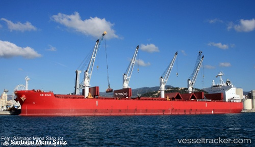
 GLYFADA
Current Status
Where is the vessel?
GLYFADA is currently in Near Lutcher, based on AIS data received less than 1h ago.
Latest AIS update:
Current position: 30.02880° N, 90.70270° W (Near Lutcher)
Average speed (last 7 days): Loading…
Average speed (last 30 days): Loading…
Vessel profile: GLYFADA is a Bulk Carrier with dimensions 199m x 32m.
This page combines live AIS, route history, probable destination signals, nearby traffic, and port activity for practical vessel monitoring.
The current position of vessel GLYFADA is 30.0288 lat / -90.7027 lng. Updated: 2026-04-08 11:20:14 UTCNearest reference points:
- Near Port Of South Louisiana
- Near Good Hope
- Near Boutte
Currently sailing under the flag of Malta ![]()
GLYFADA built in 2016 year
Deadweight:
60414 tDetails:
Live Vessel GLYFADA Analytics (details, animations, etc.)
Recent AIS points (UTC):
2026-04-08 05:26:11 UTC · 30.02890, -90.70280 · SOG 0 kn · COG 220°2026-04-08 07:55:57 UTC · 30.02880, -90.70270 · SOG 0 kn · COG 223°
2026-04-08 10:02:01 UTC · 30.02880, -90.70270 · SOG 0 kn · COG 225°
2026-04-08 11:20:14 UTC · 30.02880, -90.70270 · SOG 0 kn · COG 228°