 vesseltracker.com
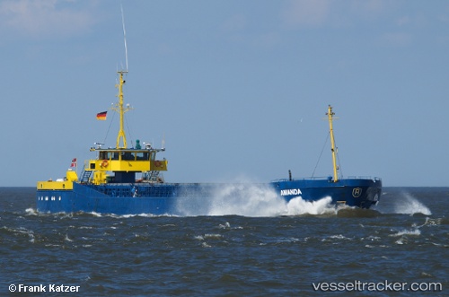
Vessel Amanda IMO: 8104565, MMSI: 219002392 General Cargo Ship
UTC, 54.3929, 18.6714, course: -1, speed: 0
UTC, 54.3929, 18.6713, course: -1, speed: 0
2026-03-03 13:45:20 UTC, 54.393, 18.6714, course: -1, speed: 0
Live AIS position:
UTC. Near Nowy Port/Gdansk),
updated 2026-03-03 13:45:20 UTC.
Find the position of the vessel Amanda on the map. The latter are known coordinates and path.
marine traffic ship tracker show on live map
The current position of vessel Amanda is 54.393 lat / 18.6714 lng. Updated: 2026-03-03 13:45:20 UTCCurrently sailing under the flag of Denmark
Amanda built in 1981 year
Deadweight:
1795 tDetails:
Last coordinates of the vessel:
UTC, 54.3929, 18.6714, course: -1, speed: 0UTC, 54.3929, 18.6714, course: -1, speed: 0
UTC, 54.3929, 18.6713, course: -1, speed: 0
2026-03-03 13:45:20 UTC, 54.393, 18.6714, course: -1, speed: 0