 vesseltracker.com
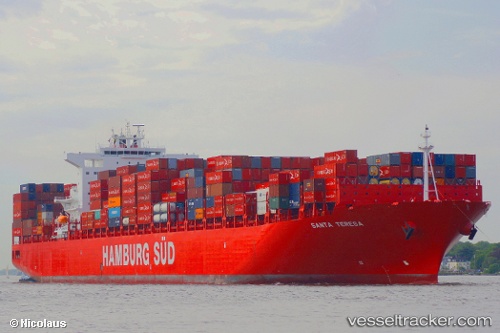
 Santa Teresa
Current Status
Where is the vessel?
Santa Teresa is currently in Open sea (no nearby ports in database), based on AIS data received less than 1h ago.
Latest AIS update:
Current position: 17.48202° S, 2.69775° E (Open sea (no nearby ports in database))
Average speed (last 7 days): Loading…
Average speed (last 30 days): Loading…
Vessel profile: Santa Teresa is a Container Ship with dimensions 300m x 300m.
This page combines live AIS, route history, probable destination signals, nearby traffic, and port activity for practical vessel monitoring.
The current position of vessel Santa Teresa is -17.48202 lat / 2.69775 lng. Updated: 2026-04-07 10:21:46 UTCNearest reference points:
- Open sea (no nearby ports in database)
Currently sailing under the flag of Denmark ![]()
Santa Teresa built in 2011 year
Deadweight:
93590 tDetails:
Live Vessel Santa Teresa Analytics (details, animations, etc.)
Recent AIS points (UTC):
2026-04-07 04:17:54 UTC · -18.78407, 3.73105 · SOG 16.4 kn · COG 323°2026-04-07 06:14:31 UTC · -18.35167, 3.39167 · SOG 16 kn · COG -1°
2026-04-07 07:22:11 UTC · -18.11214, 3.20267 · SOG 16.1 kn · COG 323°
2026-04-07 10:21:46 UTC · -17.48202, 2.69775 · SOG 15.7 kn · COG 322°