 vesseltracker.com
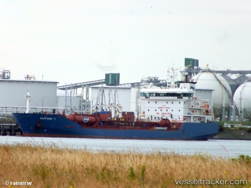
Vessel KATTEGAT IMO: 9432866, MMSI: 219222000 Chemical/Oil Products Tanker
UTC, 51.26352, 4.34496, course: 138, speed: 0.2
UTC, 51.26347, 4.34498, course: 138, speed: 0.2
2026-03-01 17:33:51 UTC, 51.26349, 4.34498, course: 138, speed: 0.1
Live AIS position:
UTC. Near Pijp Tabak),
updated 2026-03-01 17:33:51 UTC.
Find the position of the vessel KATTEGAT on the map. The latter are known coordinates and path.
marine traffic ship tracker show on live map
The current position of vessel KATTEGAT is 51.26349 lat / 4.34498 lng. Updated: 2026-03-01 17:33:51 UTCCurrently sailing under the flag of Denmark (DIS)
KATTEGAT built in 2008 year
Deadweight:
11299 tDetails:
Last coordinates of the vessel:
UTC, 51.26197, 4.34721, course: 138, speed: 0.2UTC, 51.26352, 4.34496, course: 138, speed: 0.2
UTC, 51.26347, 4.34498, course: 138, speed: 0.2
2026-03-01 17:33:51 UTC, 51.26349, 4.34498, course: 138, speed: 0.1