 vesseltracker.com
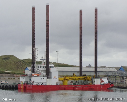
 Wind
Wind
Current Status
Where is the vessel?
Wind is currently in 29 nm NW of Wenningstedt, based on AIS data received about 1h ago.
Latest AIS update:
Current position: 55.14397° N, 7.55394° E (29 nm NW of Wenningstedt)
Average speed (last 7 days): Loading…
Average speed (last 30 days): Loading…
Vessel profile: Wind is a Service Ship with dimensions 55m x 18m.
This page combines live AIS, route history, probable destination signals, nearby traffic, and port activity for practical vessel monitoring.
The current position of vessel Wind is 55.14397 lat / 7.55394 lng. Updated: 2026-04-07 19:57:50 UTCNearest reference points:
- Near Blavand
- Near Basel
- Near Fanoe
Currently sailing under the flag of Denmark ![]()
Wind built in 1996 year
Deadweight:
1463 tDetails:
Live Vessel Wind Analytics (details, animations, etc.)
Recent AIS points (UTC):
2026-04-07 14:13:51 UTC · 54.60070, 7.85189 · SOG 5.8 kn · COG 335°2026-04-07 16:22:01 UTC · 54.79686, 7.72650 · SOG 6.3 kn · COG 344°
2026-04-07 17:51:31 UTC · 54.94340, 7.65017 · SOG 6.1 kn · COG 346°
2026-04-07 19:57:50 UTC · 55.14397, 7.55394 · SOG 5.6 kn · COG 350°