 vesseltracker.com
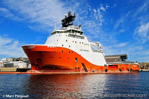
 ABEILLE MEDITERRANEE
Current Status
Where is the vessel?
ABEILLE MEDITERRANEE is currently in Near LA SEYNE-SUR-MER, based on AIS data received less than 1h ago.
Latest AIS update:
Current position: 43.11539° N, 5.92550° E (Near LA SEYNE-SUR-MER)
Average speed (last 7 days): Loading…
Average speed (last 30 days): Loading…
Vessel profile: ABEILLE MEDITERRANEE is a Offshore Tug/Supply Ship with dimensions 91m x 22m.
This page combines live AIS, route history, probable destination signals, nearby traffic, and port activity for practical vessel monitoring.
The current position of vessel ABEILLE MEDITERRANEE is 43.11539 lat / 5.92550 lng. Updated: 2026-04-20 05:59:29 UTCNearest reference points:
- Near SAINT MANDRIER
- Near Six-Fours-les-Plages
- Near LA CIOTAT
Currently sailing under the flag of France ![]()
ABEILLE MEDITERRANEE built in 2010 year
Deadweight:
4250 tDetails:
Live Vessel ABEILLE MEDITERRANEE Analytics (details, animations, etc.)
Recent AIS points (UTC):
2026-04-20 02:17:29 UTC · 43.11541, 5.92550 · SOG 0 kn · COG 261°2026-04-20 03:41:35 UTC · 43.11539, 5.92551 · SOG 0 kn · COG 261°
2026-04-20 04:36:12 UTC · 43.11500, 5.92500 · SOG 0 kn · COG -1°
2026-04-20 05:59:29 UTC · 43.11539, 5.92550 · SOG 0 kn · COG 261°