 vesseltracker.com
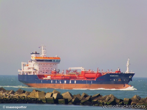
Vessel Ym Miranda IMO: 9554755, MMSI: 229370000 Chemical Oil Products Tanker
UTC, 41.33633, 2.18783, course: 214, speed: 0
UTC, 41.33483, 2.18883, course: 273, speed: 0.1
2026-01-28 16:11:55 UTC, 41.33414, 2.18879, course: 289, speed: 0.3
Live AIS position:
UTC. Near Barcelona),
updated 2026-01-28 16:11:55 UTC.
Find the position of the vessel Ym Miranda on the map. The latter are known coordinates and path.
marine traffic ship tracker show on live map
The current position of vessel Ym Miranda is 41.33414 lat / 2.18879 lng. Updated: 2026-01-28 16:11:55 UTCCurrently sailing under the flag of Malta
Ym Miranda built in 2013 year
Deadweight:
12933 tDetails:
Last coordinates of the vessel:
UTC, 41.33633, 2.18817, course: 211, speed: 0.1UTC, 41.33633, 2.18783, course: 214, speed: 0
UTC, 41.33483, 2.18883, course: 273, speed: 0.1
2026-01-28 16:11:55 UTC, 41.33414, 2.18879, course: 289, speed: 0.3