 vesseltracker.com
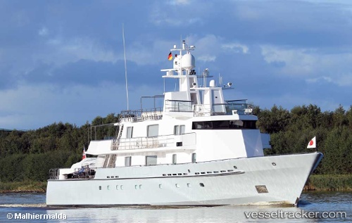
 RONIN
RONIN
Current Status
Where is the vessel?
RONIN is currently in Near Genova, based on AIS data received about 2h ago.
Latest AIS update:
Current position: 44.40886° N, 8.92072° E (Near Genova)
Average speed (last 7 days): Loading…
Average speed (last 30 days): Loading…
Vessel profile: RONIN is a Houseboat with dimensions 9m x 58m.
This page combines live AIS, route history, probable destination signals, nearby traffic, and port activity for practical vessel monitoring.
The current position of vessel RONIN is 44.40886 lat / 8.92072 lng. Updated: 2026-04-17 05:33:56 UTCNearest reference points:
- Near Genova
- Near Sestri Ponente
- Near Multedo
Currently sailing under the flag of Malta ![]()
RONIN built in 1993 year
Deadweight:
0 tDetails:
Live Vessel RONIN Analytics (details, animations, etc.)
Recent AIS points (UTC):
2026-04-16 23:24:52 UTC · 44.40890, 8.92072 · SOG 0 kn · COG 345°2026-04-17 02:36:53 UTC · 44.40884, 8.92070 · SOG 0 kn · COG 345°
2026-04-17 03:42:54 UTC · 44.40884, 8.92067 · SOG 0 kn · COG 346°
2026-04-17 05:33:56 UTC · 44.40886, 8.92072 · SOG 0 kn · COG 342°