 vesseltracker.com
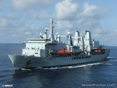
 Rfa Fort Victoria
Current Status
Where is the vessel?
Rfa Fort Victoria is currently in Near TRANMERE, based on AIS data received about 444d ago.
Latest AIS update:
Current position: 53.38493° N, 3.00992° W (Near TRANMERE)
Average speed (last 7 days): Loading…
Average speed (last 30 days): Loading…
Vessel profile: Rfa Fort Victoria is a Chemical Oil Products Tanker with dimensions 203m x 30m.
This page combines live AIS, route history, probable destination signals, nearby traffic, and port activity for practical vessel monitoring.
The current position of vessel Rfa Fort Victoria is 53.38493 lat / -3.00992 lng. Updated: 2025-01-09 09:24:57 UTCNearest reference points:
- Near BIRKENHEAD
- Near ELLESMERE
- Near LIVERPOOL ANCH
Currently sailing under the flag of United Kingdom ![]()
Rfa Fort Victoria built in 1993 year
Deadweight:
16967 tDetails:
Live Vessel Rfa Fort Victoria Analytics (details, animations, etc.)
Recent AIS points (UTC):
2025-01-09 09:24:57 UTC · 53.38493, -3.00992 · SOG 0 kn · COG -1°