 vesseltracker.com
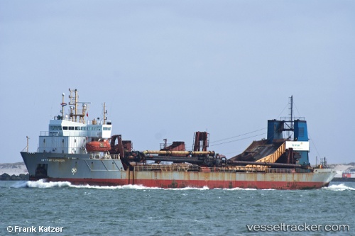
Vessel City Of London IMO: 8806058, MMSI: 233322000 Dredger
UTC, 54.58012, -1.20544, course: -1, speed: 0
UTC, 54.58012, -1.20544, course: -1, speed: 0
2026-03-02 16:16:28 UTC, 54.58012, -1.20544, course: -1, speed: 0
Live AIS position:
UTC. Near Middlesbrough),
updated 2026-03-02 16:16:28 UTC.
Find the position of the vessel City Of London on the map. The latter are known coordinates and path.
marine traffic ship tracker show on live map
The current position of vessel City Of London is 54.58012 lat / -1.20544 lng. Updated: 2026-03-02 16:16:28 UTCCurrently sailing under the flag of United Kingdom
City Of London built in 1989 year
Deadweight:
5989 tDetails:
Last coordinates of the vessel:
UTC, 54.58013, -1.20544, course: -1, speed: 0UTC, 54.58012, -1.20544, course: -1, speed: 0
UTC, 54.58012, -1.20544, course: -1, speed: 0
2026-03-02 16:16:28 UTC, 54.58012, -1.20544, course: -1, speed: 0