 vesseltracker.com
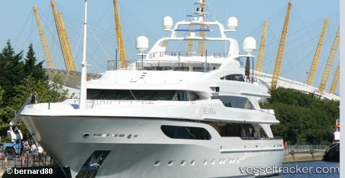
 Seanna
Current Status
Where is the vessel?
Seanna is currently in Near TROGIR, based on AIS data received less than 1h ago.
Latest AIS update:
Current position: 43.51082° N, 16.24429° E (Near TROGIR)
Average speed (last 7 days): Loading…
Average speed (last 30 days): Loading…
Vessel profile: Seanna is a Service Ship with dimensions 65m x 12m.
This page combines live AIS, route history, probable destination signals, nearby traffic, and port activity for practical vessel monitoring.
The current position of vessel Seanna is 43.51082 lat / 16.24429 lng. Updated: 2026-04-07 21:56:10 UTCNearest reference points:
- Near Rogac
- Near Split
- Near Kastel Sucurac
Currently sailing under the flag of United Kingdom ![]()
Details:
Live Vessel Seanna Analytics (details, animations, etc.)
Recent AIS points (UTC):
2026-04-07 16:23:11 UTC · 43.51083, 16.24429 · SOG 0 kn · COG 172°2026-04-07 17:53:10 UTC · 43.51083, 16.24429 · SOG 0 kn · COG 172°
2026-04-07 19:59:10 UTC · 43.51082, 16.24430 · SOG 0.1 kn · COG 172°
2026-04-07 21:56:10 UTC · 43.51082, 16.24429 · SOG 0 kn · COG 172°