 vesseltracker.com
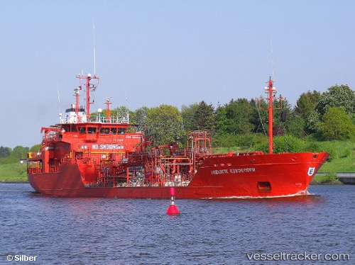
Vessel Key North IMO: 9020417, MMSI: 236669000 Chemical Oil Products Tanker
UTC, 57.03721, 24.08153, course: 124, speed: 0
UTC, 57.03724, 24.08156, course: 124, speed: 0
2026-02-05 10:06:02 UTC, 57.03725, 24.08153, course: 124, speed: 0
Live AIS position:
UTC. Near Bullu),
updated 2026-02-05 10:06:02 UTC.
Find the position of the vessel Key North on the map. The latter are known coordinates and path.
marine traffic ship tracker show on live map
The current position of vessel Key North is 57.03725 lat / 24.08153 lng. Updated: 2026-02-05 10:06:02 UTCCurrently sailing under the flag of Gibraltar
Key North built in 1992 year
Deadweight:
3743 tDetails:
Last coordinates of the vessel:
UTC, 57.03721, 24.08155, course: 124, speed: 0UTC, 57.03721, 24.08153, course: 124, speed: 0
UTC, 57.03724, 24.08156, course: 124, speed: 0
2026-02-05 10:06:02 UTC, 57.03725, 24.08153, course: 124, speed: 0