 vesseltracker.com
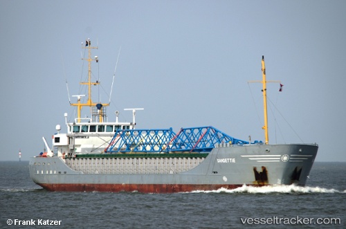
Vessel Sandettie IMO: 9214018, MMSI: 244054000 General Cargo Ship
UTC, 51.31589, 3.83116, course: -1, speed: 0
UTC, 51.31585, 3.83121, course: 128, speed: 0
2026-03-01 09:53:21 UTC, 51.31588, 3.83115, course: 128, speed: 0
Live AIS position:
UTC. Near Terneuzen),
updated 2026-03-01 09:53:21 UTC.
Find the position of the vessel Sandettie on the map. The latter are known coordinates and path.
marine traffic ship tracker show on live map
The current position of vessel Sandettie is 51.31588 lat / 3.83115 lng. Updated: 2026-03-01 09:53:21 UTCCurrently sailing under the flag of Netherlands
Sandettie built in 2004 year
Deadweight:
2934 tDetails:
Last coordinates of the vessel:
UTC, 51.31585, 3.83120, course: 128, speed: 0UTC, 51.31589, 3.83116, course: -1, speed: 0
UTC, 51.31585, 3.83121, course: 128, speed: 0
2026-03-01 09:53:21 UTC, 51.31588, 3.83115, course: 128, speed: 0