 vesseltracker.com
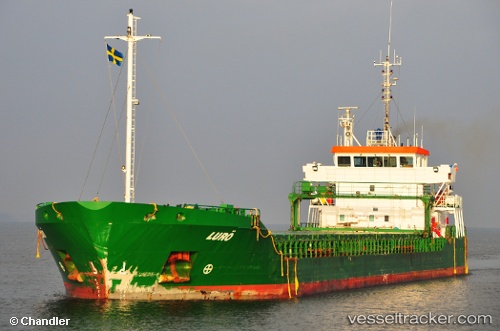
Vessel Luro IMO: 9263588, MMSI: 244059000 General Cargo Ship
UTC, 59.33831, 5.29950, course: 183, speed: 0
UTC, 59.25805, 5.33639, course: 180, speed: 8.6
2026-02-04 18:21:24 UTC, 59.15633, 4.89798, course: 300, speed: 11
Live AIS position:
UTC. Near Utsira),
updated 2026-02-04 18:21:24 UTC.
Find the position of the vessel Luro on the map. The latter are known coordinates and path.
marine traffic ship tracker show on live map
The current position of vessel Luro is 59.15633 lat / 4.89798 lng. Updated: 2026-02-04 18:21:24 UTCCurrently sailing under the flag of Netherlands
Luro built in 2003 year
Deadweight:
4919 tDetails:
Last coordinates of the vessel:
UTC, 59.33829, 5.29952, course: 183, speed: 0UTC, 59.33831, 5.29950, course: 183, speed: 0
UTC, 59.25805, 5.33639, course: 180, speed: 8.6
2026-02-04 18:21:24 UTC, 59.15633, 4.89798, course: 300, speed: 11