 vesseltracker.com
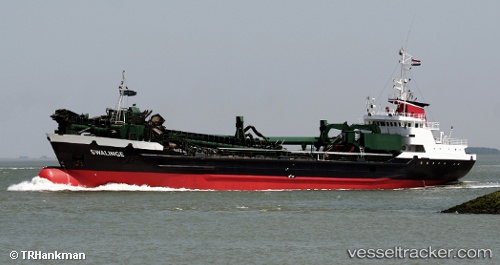
Vessel Swalinge IMO: 7637448, MMSI: 244209000 Hopper Dredger
UTC, 51.25546, 3.21577, course: 352, speed: 0
UTC, 51.25545, 3.21579, course: 352, speed: 0
2026-01-15 03:35:29 UTC, 51.25541, 3.21573, course: 352, speed: 0
Live AIS position:
UTC. Near Dudzele),
updated 2026-01-15 03:35:29 UTC.
Find the position of the vessel Swalinge on the map. The latter are known coordinates and path.
marine traffic ship tracker show on live map
The current position of vessel Swalinge is 51.25541 lat / 3.21573 lng. Updated: 2026-01-15 03:35:29 UTCCurrently sailing under the flag of Netherlands
Swalinge built in 1977 year
Deadweight:
3064 tDetails:
Last coordinates of the vessel:
UTC, 51.25544, 3.21579, course: 352, speed: 0UTC, 51.25546, 3.21577, course: 352, speed: 0
UTC, 51.25545, 3.21579, course: 352, speed: 0
2026-01-15 03:35:29 UTC, 51.25541, 3.21573, course: 352, speed: 0