 vesseltracker.com
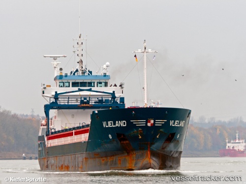
Vessel Vlieland IMO: 9313814, MMSI: 244376000 Multi Purpose Carrier
UTC, 50.72237, 1.57228, course: 196, speed: 0
UTC, 50.72237, 1.57229, course: 196, speed: 0
2026-03-08 02:47:23 UTC, 50.72237, 1.57229, course: 196, speed: 0
Live Vessel Vlieland Analytics (details, animations, etc.)
Live AIS position: UTC. Near BOULOGNE-SUR-MER), updated 2026-03-08 02:47:23 UTC.Find the position of the vessel Vlieland on the map. The latter are known coordinates and path.
marine traffic ship tracker show on live map
The current position of vessel Vlieland is 50.72237 lat / 1.57229 lng. Updated: 2026-03-08 02:47:23 UTCCurrently sailing under the flag of Netherlands
Vlieland built in 2005 year
Deadweight:
6000 tDetails:
Last coordinates of the vessel:
UTC, 50.72237, 1.57230, course: 197, speed: 0UTC, 50.72237, 1.57228, course: 196, speed: 0
UTC, 50.72237, 1.57229, course: 196, speed: 0
2026-03-08 02:47:23 UTC, 50.72237, 1.57229, course: 196, speed: 0