 vesseltracker.com
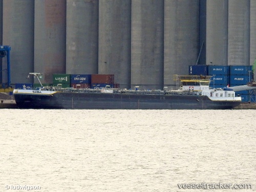
Vessel Saba IMO: 9642435, MMSI: 244750303 Chemical Oil Products Tanker
UTC, 52.04083, 5.11142, course: -1, speed: 0
UTC, 52.04082, 5.11144, course: -1, speed: 0
2026-01-16 21:45:44 UTC, 52.04082, 5.11144, course: -1, speed: 0
Live AIS position:
UTC. Near NIEUWEGEIN),
updated 2026-01-16 21:45:44 UTC.
Find the position of the vessel Saba on the map. The latter are known coordinates and path.
marine traffic ship tracker show on live map
The current position of vessel Saba is 52.04082 lat / 5.11144 lng. Updated: 2026-01-16 21:45:44 UTCCurrently sailing under the flag of Netherlands
Details:
Last coordinates of the vessel:
UTC, 52.04083, 5.11143, course: -1, speed: 0UTC, 52.04083, 5.11142, course: -1, speed: 0
UTC, 52.04082, 5.11144, course: -1, speed: 0
2026-01-16 21:45:44 UTC, 52.04082, 5.11144, course: -1, speed: 0