 vesseltracker.com
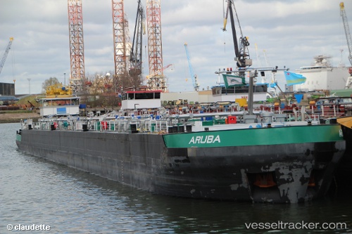
Vessel Aruba IMO: 9638989, MMSI: 244750309 Other Tanker
UTC, 51.26443, 4.35119, course: -1, speed: 0
UTC, 51.26440, 4.35119, course: -1, speed: 0
2026-03-02 19:36:03 UTC, 51.26442, 4.35121, course: -1, speed: 0
Live AIS position:
UTC. Near Pijp Tabak),
updated 2026-03-02 19:36:03 UTC.
Find the position of the vessel Aruba on the map. The latter are known coordinates and path.
marine traffic ship tracker show on live map
The current position of vessel Aruba is 51.26442 lat / 4.35121 lng. Updated: 2026-03-02 19:36:03 UTCCurrently sailing under the flag of Netherlands
Details:
Last coordinates of the vessel:
UTC, 51.26443, 4.35121, course: -1, speed: 0UTC, 51.26443, 4.35119, course: -1, speed: 0
UTC, 51.26440, 4.35119, course: -1, speed: 0
2026-03-02 19:36:03 UTC, 51.26442, 4.35121, course: -1, speed: 0