 vesseltracker.com
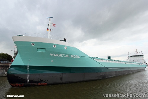
Vessel Marietje Nora IMO: 9481609, MMSI: 244860007 Multi Purpose Carrier
UTC, 59.12591, 9.61635, course: 45, speed: 0
UTC, 59.12587, 9.61635, course: 45, speed: 0
2026-01-18 16:49:01 UTC, 59.12587, 9.61635, course: 45, speed: 0
Live AIS position:
UTC. Near PORSGRUNN),
updated 2026-01-18 16:49:01 UTC.
Find the position of the vessel Marietje Nora on the map. The latter are known coordinates and path.
marine traffic ship tracker show on live map
The current position of vessel Marietje Nora is 59.12587 lat / 9.61635 lng. Updated: 2026-01-18 16:49:01 UTCCurrently sailing under the flag of Netherlands
Details:
Last coordinates of the vessel:
UTC, 59.12589, 9.61635, course: 45, speed: 0UTC, 59.12591, 9.61635, course: 45, speed: 0
UTC, 59.12587, 9.61635, course: 45, speed: 0
2026-01-18 16:49:01 UTC, 59.12587, 9.61635, course: 45, speed: 0