 vesseltracker.com
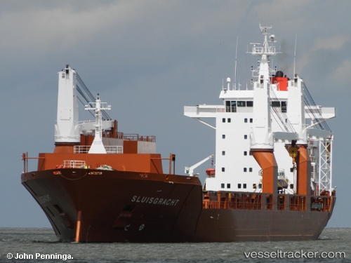
Vessel Sluisgracht IMO: 9202522, MMSI: 244903000 Multi Purpose Carrier
UTC, 39.21206, -76.47783, course: -1, speed: 0
UTC, 39.21209, -76.47783, course: -1, speed: 0
2026-03-04 17:34:57 UTC, 39.21206, -76.47780, course: -1, speed: 0
Live Vessel Sluisgracht Analytics (details, animations, etc.)
Live AIS position: UTC. Near Sparrows Point), updated 2026-03-04 17:34:57 UTC.Find the position of the vessel Sluisgracht on the map. The latter are known coordinates and path.
marine traffic ship tracker show on live map
The current position of vessel Sluisgracht is 39.21206 lat / -76.47780 lng. Updated: 2026-03-04 17:34:57 UTCCurrently sailing under the flag of Netherlands
Sluisgracht built in 2001 year
Deadweight:
21250 tDetails:
Last coordinates of the vessel:
UTC, 39.21207, -76.47782, course: 262, speed: 0UTC, 39.21206, -76.47783, course: -1, speed: 0
UTC, 39.21209, -76.47783, course: -1, speed: 0
2026-03-04 17:34:57 UTC, 39.21206, -76.47780, course: -1, speed: 0