 vesseltracker.com
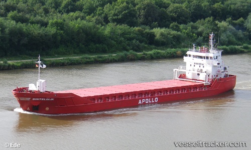
Vessel Dinteldijk IMO: 9346677, MMSI: 245044000 Multi Purpose Carrier
UTC, 43.40987, 4.91895, course: 287, speed: 0.1
UTC, 43.40833, 4.91833, course: -1, speed: 0
2026-02-01 02:14:29 UTC, 43.40833, 4.91833, course: -1, speed: 0
Live AIS position:
UTC. Near Fos-sur-Mer),
updated 2026-02-01 02:14:29 UTC.
Find the position of the vessel Dinteldijk on the map. The latter are known coordinates and path.
marine traffic ship tracker show on live map
The current position of vessel Dinteldijk is 43.40833 lat / 4.91833 lng. Updated: 2026-02-01 02:14:29 UTCCurrently sailing under the flag of Netherlands
Dinteldijk built in 2007 year
Deadweight:
4450 tDetails:
Last coordinates of the vessel:
UTC, 43.40979, 4.91886, course: 288, speed: 0.1UTC, 43.40987, 4.91895, course: 287, speed: 0.1
UTC, 43.40833, 4.91833, course: -1, speed: 0
2026-02-01 02:14:29 UTC, 43.40833, 4.91833, course: -1, speed: 0