 vesseltracker.com
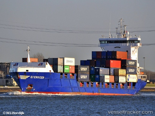
Vessel Energizer IMO: 9299501, MMSI: 245088000 Container Ship
UTC, 56.02992, 12.69171, course: 357, speed: 0
UTC, 56.19358, 12.44423, course: 348, speed: 11.9
2026-03-05 21:27:45 UTC, 56.54024, 12.66314, course: 59, speed: 12.4
Live Vessel Energizer Analytics (details, animations, etc.)
Live AIS position: UTC. Near Halmstad), updated 2026-03-05 21:27:45 UTC.Find the position of the vessel Energizer on the map. The latter are known coordinates and path.
marine traffic ship tracker show on live map
The current position of vessel Energizer is 56.54024 lat / 12.66314 lng. Updated: 2026-03-05 21:27:45 UTCCurrently sailing under the flag of Netherlands
Energizer built in 2004 year
Deadweight:
9500 tDetails:
Last coordinates of the vessel:
UTC, 56.02988, 12.69173, course: 358, speed: 0UTC, 56.02992, 12.69171, course: 357, speed: 0
UTC, 56.19358, 12.44423, course: 348, speed: 11.9
2026-03-05 21:27:45 UTC, 56.54024, 12.66314, course: 59, speed: 12.4