 vesseltracker.com
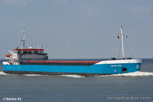
Vessel Carolina IMO: 9382748, MMSI: 245137000 General Cargo Ship
UTC, 55.17906, 14.36967, course: 41, speed: 9.5
UTC, 55.19065, 14.38601, course: 40, speed: 9.5
2026-01-19 04:25:15 UTC, 55.47526, 14.96947, course: 61, speed: 9.3
Live AIS position:
UTC. 12 nm NW of Christiansø Havn),
updated 2026-01-19 04:25:15 UTC.
Find the position of the vessel Carolina on the map. The latter are known coordinates and path.
marine traffic ship tracker show on live map
The current position of vessel Carolina is 55.47526 lat / 14.96947 lng. Updated: 2026-01-19 04:25:15 UTCCurrently sailing under the flag of Netherlands
Carolina built in 2008 year
Deadweight:
3697 tDetails:
Last coordinates of the vessel:
UTC, 55.04749, 14.18653, course: 41, speed: 9.4UTC, 55.17906, 14.36967, course: 41, speed: 9.5
UTC, 55.19065, 14.38601, course: 40, speed: 9.5
2026-01-19 04:25:15 UTC, 55.47526, 14.96947, course: 61, speed: 9.3